It looks like I will make it back onto the trail in July! I had wanted to pick up where I left off in Vermont but I may end up in Georgia since my sister's family is in Atlanta.
In the mean time, I have decided to post some of my "training hikes" for the AT.
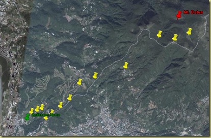
I was traveling in China and Taiwan for the last couple of weeks and one day while visiting with my brother's (Kyle) family in Taipei, I decided to go on an adventure! From my brother's apartment in Zhu Wei you can see a good sized mountain that looks a few kilometers away. I decided to go for it and for the first big hill I was accompanied by Jenny and Abby (sister-in-law and niece). I left them at about 10:00am with a water bottle, a camera, a faint recollection of where they lived and with a strong desire to get to the top of the mountain. What I didn't bring was a map, any food, or my brain apparently!
The hike was actually fairly well marked and started as more of a rural walking path, well marked by the city. I ended up cresting a few summits and realizing the path I was on wasn't leading to my original goal but could now I could see a more attractive goal. I decided to go for it! The well marked trail turned into more of a series of paved marked walking paths broken by narrow winding roads. Luckily the trails had plenty of people on them so I would usually just follow someone else. In the mean time, I climbed what must have been thousands of steps, asked for help at least a few times and passed all kinds of small rural farms, memorials built to ancestors, and views of the smog enveloped city increasingly far away.
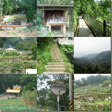
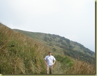
After a couple of hours, I arrived at a true trailhead in an off-the-beaten path entrance to a National Park. Now we were getting somewhere.... I saw a map and although I couldn't pick up on all the Chinese there was enough English, meter markers, and maps for me to identify my goal and feel confident that I could make it. I was about 4 km from my goal and it looked like around 2000ft of elevation gain. I still had a good hike ahead of me.
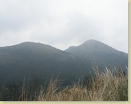
I eventually made my goal at around 1:00pm but was out of water, tired and without food. Time to go home!
As I was about to head down the hill, a nice older couple who had shadowed me on the final ascent asked if I was going back down. After replying that I was, they asked if I had eaten. Nope. I graciously accepted some food (I really have no idea how to describe what it was) and when they learned I didn't have water they gave me a green tomato as well. I was very grateful for their charity (and a little remorseful for my stupidity) and started heading home.
I knew I could retrace my steps and get home but also knew that going the exact way I came required a 1000ft up and down in about a 1.5km space. I wasn't in a condition to attack that so I decide to triangulate a little. I knew there was a junction of two separate trails that I had been on and that it was likely to bypass the mountain. I went for it. The only problem was that as I was walking, very, very thick clouds rolled in and I was not able to find what I was looking for.
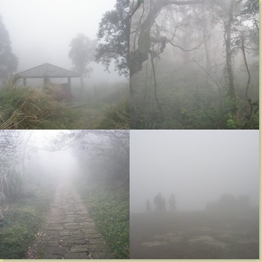
Instead I opted to follow the crowds. A bunch of people were heading down through the clouds on a path I was unfamiliar with. I quickly realized this was a good thing and I needed to get out of the mountains and get home. Kyle and Jenny were expecting me around 3:00 and it was clear I was going to miss that mark.
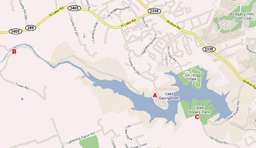
My decision paid off and I ended up a visitor's center on the park's main road. I was able to take care of the most critical thing....hydrating.
Now that I was out of risk of physical harm. How the heck was I supposed to get home? While hiking around I had pondered this point and was able to recall the town they were in (Zhu Wei) and the street where one of their friends lived (Min Zhu Lu) and I knew how to get to their place from there. I was confident that if I could get to a metro stop, I would make it home or at least within a few hundred yards of home. From there, an internet cafe would probably be my last best way of calling for help (of course, I didn't have their phone number with me!)
Luckily, things worked out exactly as planned. I relied heavily on locals who looked like they might know English. 2 busses, 8 metro stops, and 2.5 hours later, I arrived back at the apartment (to at least a little bit of relief from the family!)
OK.... so by now you are thinking, "Craig is an idiot." I would have to agree but said another way, I learned a few things.....
- Plan ahead and don't take off without the plan. I already knew this, of course, but it just goes to show you that you can still make the wrong choices.
- Map, water and food. Dugh!
- I never panicked. I did something right?! Seriously though, it was good for me to observe myself handling the situation well. This was a good thing for my confidence as I follow my desires to head into increasingly challenging adventures.
When it was all said and done, I had climbed from sea level to over 3000ft, probably covered somewhere in the neighborhood of 10km, and had summited nearly the highest peak in that National Park. Not too shabby. I'm just glad the adventure ended the way it did!
I should mention that Anne wasn't impressed! She let me know how silly that was and pointed out that this video could have been what they showed on 60 minutes when they did a special on the American hiker that got lost in Taiwan.
.JPG)