Monday, December 19, 2011

Mount Frissell-South Slope (Connecticut Highpoint)


After the two hour drive from New Jersey and lunch near Salibury, we made our way to the Connecticut highpoint trailhead. This turned out to be one of those highpoint where the route finding on the road was going to be more challenging than the route finding on foot.

The guidebooks I read warned that the 5 or 6 miles traveled on gravel road might be closed in the winter but I opted to follow the primary route instead of looking for an alternate.  Sure enough, about 5 miles from the trailhead there was a large cement barrier half blocking the road and a road closed sign.  I did say it was HALF blocking the road, right?  Onward!  The road was in great shape but I kept waiting to hit the other side of the closed road barricade expecting that one side was left semi-open for people needing legitimate access while the other would be completely blocked.  Luckily, when we ran up against the next cement barricade (completely blocking the road), we were about 50 yards from the trailhead and MA-CT state line.  After turning the dead end into our personal parking lot, the boys and I hit the trail.  It was still cold out but had warmed a little since our stop in New Jersey earlier that today.


The hike is a nice flat trail for the first quarter mile or so before taking a path more or less straight up to the summit of Round Mountain.  Soren more or less bounded up while Sy slowed a little after an initial burst of energy.  We all reached the top another 1/2 mile or so later in good spirits although Sy's attitude darkened noticeably when he realized the goal was the next peak over.  Soren on the other hand insisted on taking lead and announcing the arrival of every red blaze insuring we were on the right track! 

(on Round Mountain summit.  Notice the red blaze!)

After descending Round Mountain and making a more or less identical kind of ascent up Mount Frissell, we reached the summit and signed the log.  Sy rested at the peak while Soren and I continued south until reaching the highpoint marker at the MA-CT state line a 1/10th mile or so south of the summit.  The views from Round Mountain where great and some of the lookouts around Mount Frissell were nice as well.

 (small copper(?) rod just below my right knee marks the highpoint)

We made short work of the return trip and although we had a couple of less fun moments along the way, both made the return trip in high spirits and commented on what a fun day it had been.  I can only hope to have many more.


High Point (New Jersey Highpoint)

After a little bit of a frustrating spell at work, I decided I needed a day off so after taking care of a few Church responsibilities on Sunday, the boys and I hopped in the car and headed to Point Jervis (Pennsylvania?).  I made sure to pick a hotel with an indoor pool which pretty much sold the boys on the whole hiking adventure idea. 

After breakfast the next morning and another dip in the pool, we drove all the way up to the New Jersey highpoint named.... High Point.  This one had easily the most grand monument I have seen at any other highpoint and was kind of a focal point of the state park it calls home.  The park actually seemed like a pretty cool spot with a ton of picnicking sites, spotted with small ponds and in the winter is a x-country ski park. 


Our stop was brief for two reasons (1) there was no real hiking involved and (2) it was freezing cold and the wind was howling!  Nobody wanted to hang out very long.  After racing back to the warmth of the car, we started the two hour drive to our next highpointing adventure......


Sunday, July 10, 2011

RPH Shelter

Unfortunately, I didn't take the time to sit down and write and entry on the 10th.  The final day on the trail is always tough to document.  It seems I always get caught up with everything else waiting for me once I leave the trail. So, it is over a week later, but I will see what I can remember.

I remember having a great night sleep without the rain fly on and waking feeling pretty refreshed expect for pretty sore feet (next time I am using boots instead of trail runners!)  We wanted to push ourselves to make it to our goal and we also had a little bit more of a timeline than we had on previous occasions as Anne was going to be picking us up.

Peter's knee was hurting him pretty badly so whether or not he was going to make it all the way or stop at another road and get picked up later was kind of hour by hour decision.  In the end, we opted to just take things at a slower, more consistent pace, and that worked out for both of us.  He was able to finish the hike and I have to say, I enjoyed the more leisurely pace quite a bit!  For one thing, we needed less breaks and ended up maintaining a faster pace.

At one point during the first 4 miles on the trail, we almost double backed and started heading the wrong way.  That was very nearly a big disaster.  Luckily we realized our mistake after a 100 yards or so and were back on track.  Eventually we arrived at the south end of Canopus lake and started the hike around it.  We stopped for lunch around noon when we bumped into Big Country and Aaron eating lunch on the trail very near the north end of the lake.  They had just scored a bunch of free food from another thru hiker (Tiger) who it seems they regularly hike with.  As we were leaving at the end of the day, we off loaded our extra food as well.  They were glad to receive it.

Additionally, we may have helped land Aaron his trail name. During lunch, Big Country started laughing about how Aaron accidentally had thrown his pot, which they had just bought, in the fire while cleaning up after dinner.  The guy who had sold it to him had had a lot of varieties of the stuff and this particularly one had been called Reg or Reggie.  After a few good laughs, the thought cam to me "That is your trail name. Reggie!"  It is up to Big Country now but I am guessing this one is going to stick.... it comes with a painful/funny story and all.

After lunch, we pressed on passing a beautiful open summit at Shenandoah Mountain and rested a couple miles from the RPH shelter at a road crossing. Peter decided to press on at this last chance and we moved along.

Trail Magic!  First of all, the RPH shelter is amazing.  It is a cinder block structure, with nice bunks, and is well maintained.  There is even a club of locals who have adopted the shelter as there own.  As it turns out, they were having a trail work party that day and had coolers of ice cold drinks, BBQ, and salad which they were enjoying and sharing with the passers by.  Although I was .25 miles from Anne and the boys, I had to stop for a while!  2 Sprites, some chips and pork chop later and I was feeling great.  It is amazing to me the amount of effort so many people put into the trail and around the trail culture.  I know I get a lot personally out of being out there but it is a whole other thing to invest so much of yourself back into it.  Pretty awesome people....

Eventually I sprinted up the hill to the road and meet Anne under the Taconic State Parkway underpass.  The boys were excited to see me but commented a few times how unexcited they were to smell me!  After a drive to White Plains we all enjoyed a much deserved burger at a burger house before dropping Peter off at the train station. 

It was a great trip.  I am looking forward to duplicating the success as often as possible.  Backpacking and banking may in fact be incompatible but I was pleased to have figured out this weekend at least! 


Mileage: 11.0 miles

Saturday, July 9, 2011

Dennytown Road Group Campsite


The day started early... I didn't have a watch but I bet it was before 6:00am.  At least it started out dry!  Before long, the sun was shining through the canopy and started to dry things out.  It must have rained until 4:00-5:00am.  Unfortunately, we weren't going to be able to wait around for things to dry out so we packed up wet tents and gear, put on wet clothes and hit the trail.  It reminded me of my long section through VT and NH where I was rained on every day for more than 10 days.  Peter got up at 7:45 so I burned a lot of time messing with gear, relaxing and enjoying the morning.  I enjoyed the quiet.


We passed the first 4 miles extremely quickly, talking about our philosophies regarding personal finance and talking about Peter's parents histories.  Before long, we popped out on Route 9 be the Appalachian Market. So what if it was only 11:00am... time for a Turkey Club and some Gatorade!  Also, interesting tid bit: this run of the mill convenience store and gas station has easily the nicest public bathroom I have ever seen in that kind of establishment... flat screen TV playing the news, plants, etc.

After that it was back on the trail.  The day was sunny and dry but surprisingly not hot especially under the forest canopy. We ran into the couple we met briefly at Bear Mountain Inn.  They, and a lot of other thru hikers, opted to rent motel rooms in town instead of camping out in the rain last night!  At one point we picked up a woman's hiking shoe that had dropped off a pack and guessed correctly that the owner was a NOBO hiker (hadn't seen any SOBO women hikers) as we found her and her companion a mile or so later.

My body was pretty tight and sore today and I developed a huge blister on my pinky toe but took care of food and hydration so there was no repeat of cramping today.

Peter and I enjoyed a couple of rest stops, one on a stone wall and a second by a stream where we soaked our feet while finished the other half of the Turkey Club!  Interestingly, we bumped into a day hiker we had seen on Bear Mountain just yesterday who was from Summit, NJ.  She was bringing new shoes to the woman whose lost shoe we had found earlier in the day!  The lost shoe couple was on day 2 of a 6 week hike up to Mt. Washington.


Peter's knee seems to be bothering him pretty badly but he is more fit than I am so we tend to yo-yo a bit.... me shooting ahead on down slopes and him on inclines.  In general, we make for good hiking companions as we have generally the same pace and enjoy the conversation.  It has been fun seeing his excitement for the new gear and for the adventure of backpacking.

My pack felt extra heavy all day as it and its contents were pretty wet.  When we finally made it to Dennytown Road we got the Webelos Den (and parents) to agree to let us dry everything out in the sunlight by the campsite so we and our gear our dry again!

A little more gear puttering, dinner making and..... a fire!  I love a campfire after a long day's hike.  All in all a great day... Oh! I can't forget, Peter brought a few marshmallows and we cooked them over his stove (fire was out at that point)... highly recommended.  An unexpected and welcome treat.

Now  I am laying in my tent, enjoying the sounds of the Scouts nearby skits, songs and campfire.  Definitely brings back memories.  We will have to see what tomorrow brings!  Mother nature was kind to us today.  My body is tired but I am so glad to have made it out here.  Tomorrow is the last day of this section.

Mileage: 12.3 miles

Peter's Father:  Raised in most WWII Germany and started at Mercedes as basically a custodian.  Worked his way up into the shop, eventually becoming a teacher of other mechanics and having national and international responsibilities for training.  His memories of having so little and relying on the charity of others are still evidenced in his thrift and unwillingness to throw anything away despite the plenty they have.  Very handy and kind of a motor heard (owns 15 motorcycles and cant get rid of cars)

Peter's Mother: After raising her two kids and suffering from low energy, weight problems, went on a walk with her persistent son one day.  She kept up the walking and 6 months later completed her first 10k.  Another 6 months, her first marathon.  Today she has competed in the Boston and New York marathons including winning the event in her age category!  Amazing story.  I love to hear those kinds of stories where people can make a change.  The high level of performance isn't even really the point but it makes it that much more impressive.

Friday, July 8, 2011

Hemlock Springs Campsite


First woken by a 5:30am rain squall but quickly was lulled to sleep by the same. Then my Blackberry went off at 7:00am and probably woke everyone up!  I thought I had turned that thing off.

It was nice to see the forest today.  It is your typical canopy you might find in the NE but without the density of underbrush so visibility was pretty high into the nearby forest.  The water source (spring) at the shelter seemed questionable and had a lot of debree  in it so we opted to not fill up.  Peter and I hit the trail by 8:00am.

A couple miles in I realized I had neither started this thing with enough calories of water in me... on top of it my water was low as a consequence of that morning's decision at the spring.  Basically a result of being so busy at wrk and last minute planning combined with excitedly hitting the trail without fueling up properly.  By the time we reached the top of Bear Mountain, I was cramping and feeling a little dizzy.  Luckily at the summit, Peter bought a Powerade from a vending machine and shared it and some water with me.  Oh.... and I forgot my wallet (another casualty of the rush) so I am relying on Peter for money too!  Anyway, we paused on Bear Mountain to explore the firetower, enjoy some views, dry our feet and eat lunch. 


After an hour or so we headed down the fill to Bear Mountain Inn.  The whole descent we listened to nearby ominous thunder and just as we arrived at the concession stand the rains came and escalated into a full torrent!  We enjoyed drinks and company (woman hiking w/ boyfriend... didn't get the names and he was off swimming somewhere).  The concessions guys generously filled our water for us which was appreciated as we were pretty much empty at that point.  Finally a chance to rehydrate and get some strength!

As the rain escalated, I decided to check my Blackberry for messages from the office.  Of course, there were a ton of messages (it is Friday afterall) and a staffing emergency. I had apparently left a loose end  open on a book for a client and the MD and staffer were both asking what the plan was.  I was getting a little panicked but Peter helped me think through the right response. After a few emails and a display of commitment to get the work done after coming out of the woods, my MD showed an amazing kindness by basically saying he wants me to have my vacation and he got someone else to take care of the job.  I was thankful for the result, appreciated his kindness and was relieved to have effectively reiterated my commitment to the team while still preserving my vacation time.  Time to turn the Blackberry off!

After waiting out the worst of the squall and having out significant others check the weather for us,  we learned the rain was going to be around for the rest of the day and night so we bit the bullet and took off in the rain hoping, beyond reason, that it wouldn't escalate again.  It did.  Soon enough we were soaked through.  Crossing the Hudson was on of the highlights of the day as was finally arriving at Hemlock Springs tent site a few miles passed the bridge.


This section of the trail doesn't have many shelters unfortunately.  It wasn't fun throwing up a tent in the rain but I was able to strip down, dry out and put on a dry set of clothes as the inside of the tent dried.  I am sure all my gear will still be soaking wet in the AM but at least I will sleep dry and comfortably tonight.

The water source here (spring) looks good so tomorrow should get a good start.  Since getting our tents up we have been holed up in our respective shelters but I did make it out to hang a clothes line and cook dinner during a relative break in the rain. It has been fun reading up on the trail ahead (yet another casualty of lack of preparation time before heading out) and being left to my thoughts about work and family.  I love getting out here.  On the trail life gets simple, worries are few and gratitude for it all is plentiful.  It is great to be back, soaking wet, first blister and all!

Mileage: 12.1

Thursday, July 7, 2011

William Brien Memorial Shelter

After a few years of being away, I am finally back on the AT! The investment banking job has made getting out into the woods very challenging but luckily I was able to make it happen this time.  My supervisors are being very supportive and recognize I deserve the time off and opportunity to enjoy a vacation.

That being said I still didn't make it out of the office until just before 8:30pm.  I met Peter at Grand Central station and we made our way to White Plains where Anne picked us up and ferried us to Harriman State Park and dropped us off by the side of the road where the AT crosses Seven Lakes Drive. By the time we hit the trail it was 11:00pm. We enjoyed a nice night hike despite some humidity and I couldn't help having a little skip in my step because I was back on the trail even if it is just for a couple of days!

Along the way we saw a couple of deer. It ended up being a short 2 mile night hike to William Brien shelter.  A couple of NOBO thru hikers had a campfire going when we arrived (~midnight).

After chatting for a little while I grabbed the last bunk in the shelter and Peter set up his tent. Time to catch a few Zs before a full day of hiking arrives.

Big Country - from Alabama, hiked 560 miles in 2010 and is back to try again. Started in Feb and zeroed for 30 days in Harpers Ferry to earn money some money.

Aaron (no trail name yet) - from Maine so he is walking home

Mileage: 2.0

Friday, November 26, 2010

Jerimoth Hill (Rhode Island Highpoint)

As I lived in Rhode Island for about 10 years of my life, you would think I would have hit Jerimoth Hill earlier.  No worry, I still have two siblings in the area so when Turkey Day plans landed at one of their homes (Thanks, Thompsons!),  I couldn't resist the side trip.  This time I brought along Sy and his cousin Matthew.

This particular highpoint has some colorful history but I understand this is one of the locations where the club has worked hard to improve the relationship with the owners of the land access.   It appears to be working great.  The entry sign had been knocked down and vandalized but the rest of the trail (short as it is) was well marked, perfectly maintained and in otherwise great condition.  Thanks, Highpointers!


Monday, September 6, 2010

Mount Mansfield (Vermont Highpoint)

I needed to scratch my hiking itch and the family was getting a little stir crazy during the first half of Labor Day weekend so Anne, the boys and I made a game time decision and headed up to Vermont on Sunday morning.  We had a great trip which included a trip to the Ben & Jerry's Factory and also to the Joseph Smith Memorial and, of course, I took in a hike of Mount Mansfield while we were in the area. You can find out more about the weekend over on the family blog but I will cover the hike here.

If you start from where the Long Trail crosses VT 108, the hike is just under 2.5 miles each way and has about 2,800 ft of elevation gain.  That made for a pretty steep but enjoyable hike. The bulk of the hike is spent under Vermont's green forest blanket which eventually thins out as you approach the tree line. The trail is your typical rooted, stoned Vermont trail so you have to have to be paying attention but when the trail is that steep, the roots and rocks make for good steps too. The only sketchy parts of the hike are the rocks scrambling and some sections of the trail which are all granite.  This wasn't a real problem today but I could see how it could be pretty dangerous when the rock is wet. I started around 7:30am so the air was still cool and by the time I got up to the Alpine zone, it was actually pretty chilly. The skies were mostly sunny but the summit itself was socked in with clouds and a stiff wind made it uncomfortable to hang out for long. As you might expect, the trip down look about half the time and I got back to my car just before 10:30am. 


On the way up I crossed paths with a couple of backpackers, one of whom was thru-hiking the LT (VT-MA border to Quebec).  Other than that I didn't see anyone until after I had taken a few pictures on the summit and a lone hiker and his dog arrived from the other side of the mountain.  I enjoyed the quiet.  I haven't been on the trail as much as I would have liked to this summer and now the summer is about over so it was wonderful to soak in the remaining green before the explosion of color and cool arrives (which I plan to soak in later, as well!).  On the way down I passed a least a dozen hikers on their way up. 

Overall the hike was good exercise for the body, mind and soul.

Friday, July 16, 2010

Mount Davis (Pennsylvania Highpoint)


Getting to Mount Davis is another one that has the potential to be pretty difficult but this one has nothing to do with hiking in the woods.  It is more about the nest of country roads in the area.  Luckily both the signage on the roads and the guidebook were excellent resources in finding Mount Davis. 

During our drive we noticed that there must be a good sized population of Amish/Menonite/etc... in the area because we saw at least a few horse & buggy teams being led along the roads.


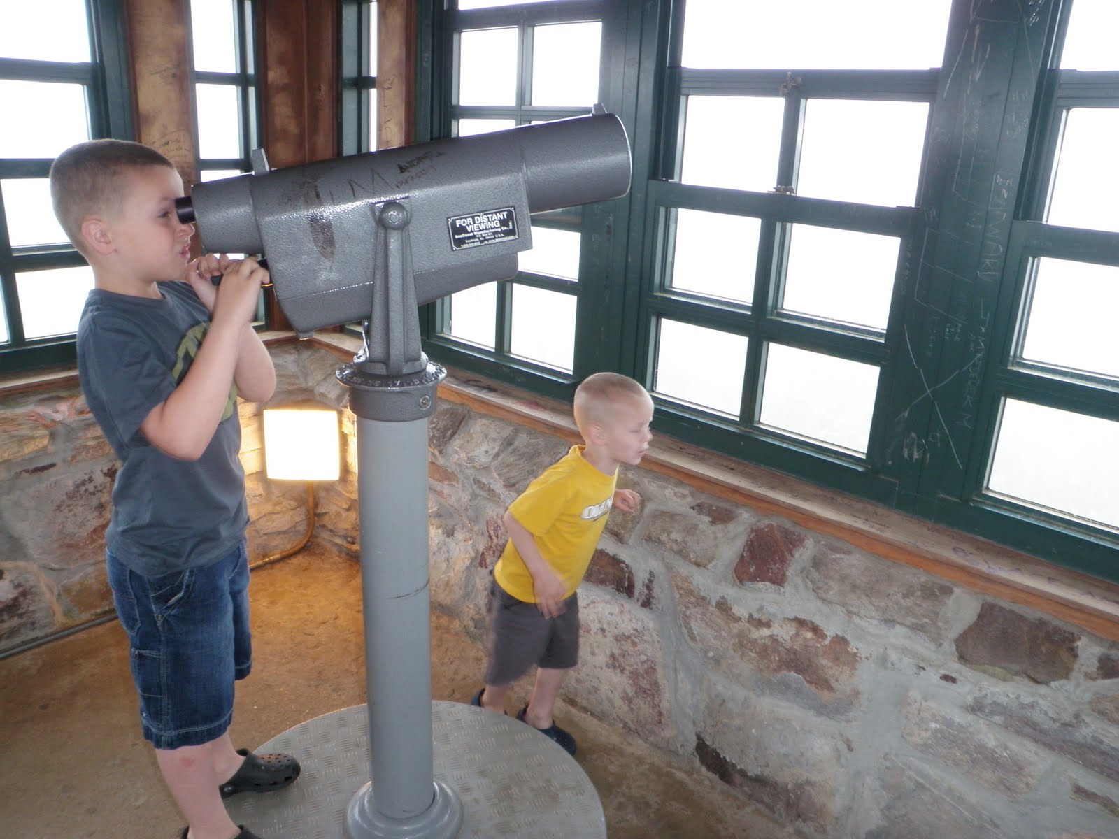
Sy really liked the observation tower on this highpoint because it was so tall.  We climbed it, snapped a few pictures and broke for the car as a rain squall looked like it wanted to get us wet.

Admittedly, I wasn't all that interested in lingering longer.  After driving almost 3,000 miles I was tired of being on the road! That being the case, I still had to make it to Vermont to drop my canoe off at a friend's house an make it back home in New York before dinner the next day.  Sy and I are both looking forward to being back home with the family.

Backbone Mountain (Maryland Highpoint)

Backbone Mountain is along the MD-WV stateline and was just a short drive (~90 min or so) from the summit at Spruce Knob.

After having hit so many "drive-up" highpoints in recent months, it was nice to go on a short hike for a change..... for me, that is.  I don't think Sy enjoyed the hike as much as I did.  It ended up being a little bit a lecture from Dad on positive mental attitude yadda yadda yadda..... I am sure he appreciated every word of it!  It is about 1 mile long each way but it is definitely a gradual climb to the ridge where the highpoint is.  The climbing along with the summer heat proved to be a little challenging for Sy.


I think if it wasn't for the guidebook and red painted "HP -->" signs along the way, I never would have found this one.  Even with all the help, we almost accidentally turned around at the state line "No. 3" marker.  It is a fairly prominent monument given its location. 


Luckily, I noticed a couple of discrepancies with dates and other descriptions of the sign and decided to go a little further because about 0.1 miles later, we found the actual highpoint.  Having achieved the goal, we snapped a couple of pictures and made our way back to the car. 

On to Pennsylvania!

Spruce Knob (West Virginia Highpoint)

Last night turned out to be a pretty big adventure in and of itself.  I wanted to get all the way to Elkins, WV so we could have a good run at WV, MD and PA before heading north and finishing our drive.  So, I kept myself awake and powered all the way to Elkins arriving around 1:00am and planned to get a hotel room and crash for the night.  Easier said than done.  The first hotel I stopped at had no vacancies.  Then the second had none.  Then more of the same at the third, fourth, fifth and sixth.  Admittedly, I hadn't anticipated that Elkins, WV of all places would be sold out!

Luckily for us, a nice lady at the Super 8 referred us to the Days Inn where they had one "interior" room.  Beggars can't be choosers so we took it.  It turns out this hotel has been converted from an old hospital. Our room literally had no exterior window but did have a window that opened into a hallway.  It was odd to say the least.  I can't say I will be recommending the accommodations to anyone else but I was grateful to have a bed nonetheless!


After a late breakfast, Sy and I drove the twisting roads to Seneca Rocks and then south to Spruce Knob park and the summit!  The drive was really nice and I was happy to be back in the wooded mountains I enjoy so much.


The highpoint has an observation tower on top that Sy and I both enjoyed especially because the views were pretty clear.  The landscape reminded me a lot of that in New England.


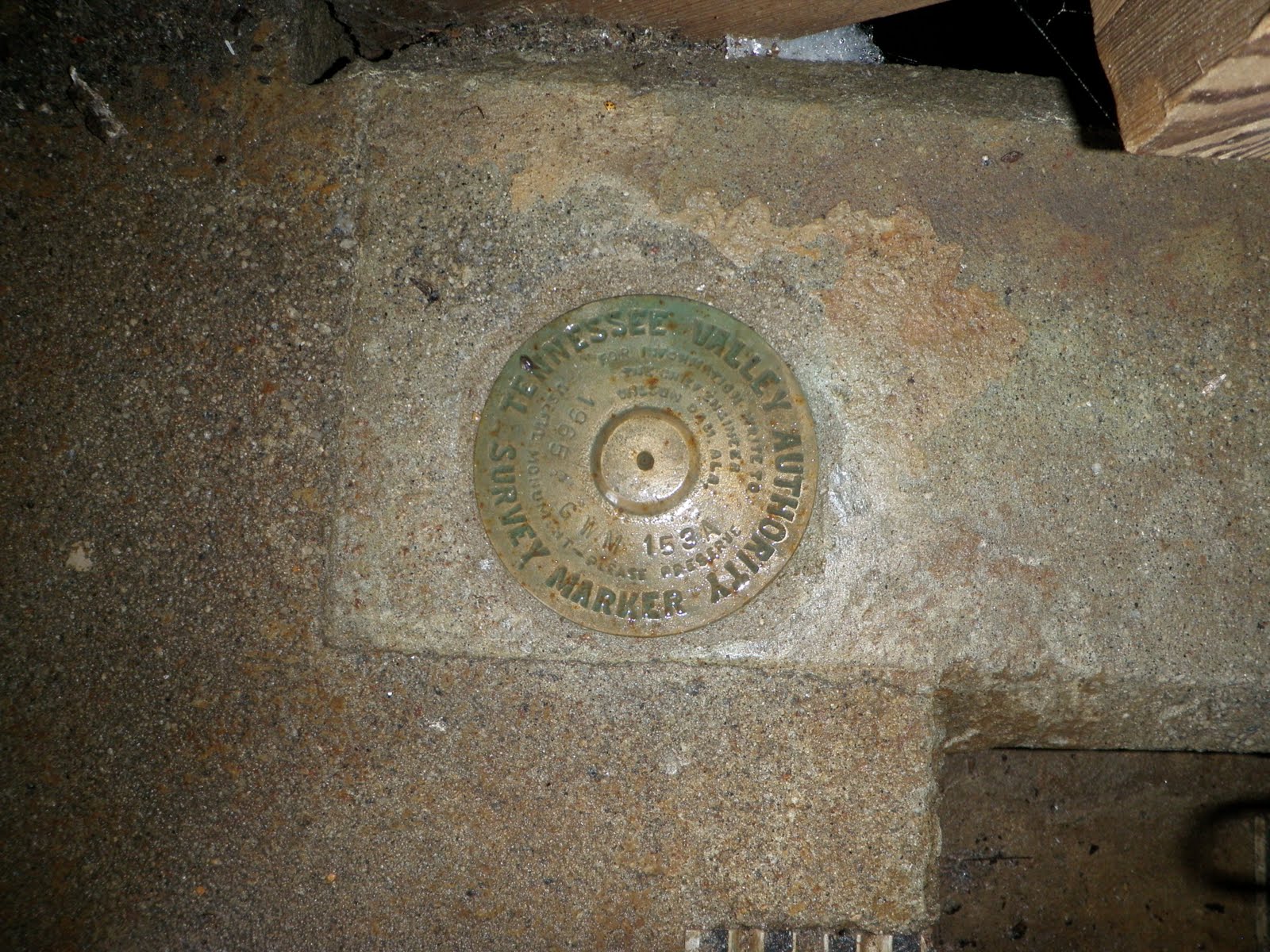
Sy had a proud moment when he was the first to find the benchmark after I had wandered for a few unsuccessful minutes of searching.  Good going, Sy!

Thursday, July 15, 2010

Campbell Hill (Ohio Highpoint)


Campbell Hill is another "drive-up" highpoint so getting there was pretty straightforward. 

The only potential confusion point is that it is located just off a parking lot in a vocational school for adults.  Even with this added complexity, it is pretty obvious where the top of the hill is.  We just kept following the drive that went up and we ran right into the highpoint.  I imagine as long as the gates are open to the school, this should be an easy one for others to find.

One thing I liked about this particular highpoint was the historical information that was included.  If you paused to read the signage, you would learn the marble stone adjacent to the benchmark was the one originally placed there and you would also learn that Campbell Hill was once an important military site during the Cold War.


Once again, after snapping a few shots, we were on our way!

Hoosier High Point (Indiana Highpoint)


Getting to Hoosier High Point was pretty straightforward and there was pretty good signage along all the approach roads.... right up to the highpoint itself. 


It was odd that the final turnoff and highpoint itself would be so poorly marked given how good signage from the main roads had been.  It did look like there had been a sign of the highpoint at some point but there were just two signpost stumps to the east of the highpoint.  I confirmed that there was a sign there as recently as June 2, 2010 using a YouTube video so we may have just recently missed it!  No big deal, though, because the book Anne had given me gave good directions so I knew to turn off the road at the edge of the wooded area.

After snapping a couple of pictures and taking a moment to sign the register, we hit the road!  We wanted to hit Campbell Hill, OH that afternoon before heading to WV.

Wednesday, July 14, 2010

Hawkeye Point (Iowa Highpoint)


Sy and I have been driving from Utah to New York for a couple of days with a canoe strapped on the roof of the Saturn Ion.  It has been a lot of fun... all except for the high winds in Wyoming almost blowing the canoe off of the car and the little kidney stone passing issue in North Platte, NE.  Other than that it has been great!

The important thing is that there is now way I was going to drive across the country and not hit a few more highpoints!

Hawkeye Point, though a few hours off of I-80, was the first one within striking distance of our route.  Note: Sy and I hit Panorama Point, NE a few months ago.

This one was as "drive-up" as they come.  I understand the farm owner recently donated the land at the actual highpoint to the government (local/county/state?) and it was obvious some recent development had been done to improve the site.  Signage was also excellent on the approach roads. 

These midwest "highpoints" make me chuckle a little as the elevation is barely distinguishable from the surrounding terrain.  Guess I just need to trust the surveyors!  Regardless, it is always fun to do a little bit of route finding and enjoy the tour of a new place as I work to arrive at the goal.

Tuesday, June 1, 2010

Mount Mitchell (North Carolina Highpoint)


Luckily our drive to Mount Mitchell was much less eventful than the drive we had just finished to Sassafras Mountain.  Anne's patience must know no limits because she was still on board with hitting North Carolina's highpoint after the South Carolina disaster.


I am glad she did too because this drive was a classic drive down a beautiful, historic highway ending with a sunset on the top of a mountain!  There is only one way to get to Mount Mitchell and it is along the Blue Ridge Parkway, a national parkway and part of the US National Park Service.  As we drove along, I felt just like I was back on the AT in Vermont.  Thick forested, damp, green mountains which hug and almost suffocate you and then unannounced lay out a spread of beautiful views for the taking.  Although it was beautiful, we didn't have a ton of extra time because the state park (and the summit) closed at 9:00pm and we were pushing the deadline.


We eventually pulled up into an empty summit parking lot at 8:45pm just behind the park ranger who was up there to close things up.  He let Soren and I walk the couple hundred yards to the summit where we snapped a couple of pictures and soaked in the sunset before jumping in the car and heading out at 8:59pm!

Although we will be within striking distance of the highpoints of West Virginia, Maryland and Pennsylvania tomorrow, I think it would be wise to call it a week and make that trip another day.....

...... on to our family's new life in New York!!!!

Sassafras Mountain (South Carolina Highpoint)


After hitting Brasstown Bald, the family jumped into the car and headed east toward South Carolina.  Our next goal was Sassafras Mountain.  If bagging Georgia's highpoint was easy and uneventful, getting to South Carolina's was the opposite.  Admittedly, I caused most of the trouble.... as usual!

It didn't start well.... after grabbing lunch for the boys, I made a wrong turn somewhere in northern Georgia. Mistake #1.  I corrected it after about 20 miles or so but still....  From there the drive was pretty uneventful and we eventually approached the junction of SC 11 and US 178 in South Carolina about 10 miles south of our goal.

Mistake #2.... even though I had less than a quarter tank of gas I chose not to stop at the station that was right there.  I figured I had plenty.  Instead I plowed forward.  The next 10 miles ended up being very steep and loaded with very sharp turns which had to effects (a) low fuel efficiency and (b) Sy complaining of some car sickness.  

Mistake #3 occurred when I shot past the turn off to Sassafras Mountain ending up a few miles into North Carolina before turning around.... all the while, burning up the little fuel we had.  Not a huge mistake under normal circumstances but under these conditions (i.e. low fuel, sick kid, increasingly frustrated spouse) it was a dangerous cocktail.  This all leads me to my mistake of omission....

Mistake #4 - I should have just pulled over!  Look... when I am out on my little adventures, I get a little bit crazy with achieving the goal (exhibit A - Mt. Datun, Taiwan  and exhibit B - Taum Sauk MT, Missouri)

I know it can be stupid but the adrenaline rush of route finding, problem solving and sometimes just pushing through can be exhilarating.  That is fine and dandy when I am flying solo or when I am with a like minded crazy person but is whole other matter when I drag the family into it.  Anyway, needless to say, Sy eventually threw up into his blanket just under a mile from the summit.  Of course, then it was time to clean up. Anne is not happy with me. We are still low on gas (like getting past the E).

After doing some damage control, we reached the parking lot on top, finished the short walk to the summit, in a swarm of mosquitoes, and Anne graciously gave me about 30 seconds to snap a picture or two before she started heading down.  I didn't deserve more than that!  We happily made it the 7 or so miles north into North Carolina and a gas station.  I am also glad to report that Anne has decided to stay married to me!

All is well that ends well..... errrrr, right?!

Brasstown Bald (Georgia Highpoint)

Memorial Day weekend with the Hansen family was awesome.  We hung out, had Sy & Kate's birthday party, attended Kate's baptism, went to a Braves game, and had fun swimming.  The Hansen & Anderson grandparents were both there and we all enjoyed the mini-family reunion.  

On Tuesday, it was time to continue our trek to New York.... with a few highpoints along the way, of course!

Our first stop was Brasstown Bald in Georgia.  Like many of the highpoints in the southeast, this one is also a state park/national forest with maintained facilities so driving close to the top is possible.  After taking a short shuttle from the parking lot to the peak, we paused to take a few pictures and explore.  After unsuccessfully looking for a benchmark, I finally asked a ranger for some help.  It turns out the benchmark is just behind a locked door which doubles as an entryway to private quarters for some of the park staff.  He was nice enough to let me have a look.


It was a beautiful day and the boys and I opted to hike down from the peak to the parking lot instead of jumping on the return shuttle.  It was fun to stretch our legs and enjoy a beautiful day before jumping back in the car!


Saturday, May 29, 2010

Cheaha Mountain (Alabama Highpoint)


We had a pretty uneventful drive from Rutledge, AL to Cheaha State Park today but it was interesting to see things change as we went north.  We left behind the coastal areas and eventually reached rolling hills and even honest to goodness mountains as we approached the state park.  The route we took from Lakewood Park in Florida required us to meander through a lot of very small towns and kept us off of freeways almost the entire time.  That made for a more entertaining drive.

This particular highpoint is much more developed than most.  There was a lodge, campgrounds, chalets, cabins, restaurant, observation tower and a number of other facilities which were all part of a state park on the mountain.  From my experience to this point, most highpoints don't have near that kind of development on them.  Well, I suppose this all made the place unique in its own right.

As you can see from the pictures, the highpoint was socked in with clouds while we were up there.  After climbing and descending the observation tower it also began to rain.  That was our signal to jump back into the car and head for Atlanta where we will be spending Memorial Day weekend with my sister, Carolyn, and her family.

Friday, May 28, 2010

Britton Hill (Florida Highpoint)

After reaching the Lousiana Highpoint this morning and making it back to the hotel, we were a little bit slow getting back on the road so I knew it was going to be tough getting to Britton Hill in Florida before it got dark.

As it turns out, the long drive, traffic in Mobile, and extended meal breaks all conspired to make us miss daylight at the highpoint by just around 30 min.  No matter though, we still arrived (a little after 8:00pm) and Sy and Soren joined me for a few pictures before jumping back in the car and working our way up north.


The funny thing about this highpoint is that I had been within a 30 min drive of this spot at least 4 times in recent years.  My family has had a couple of family reunions near Walton Beach just south of  here!  It may seem like a long detour for just this purpose but it felt good to achieve this highpoint... who knows when I will be in the area again!